ROV Survey Inspections
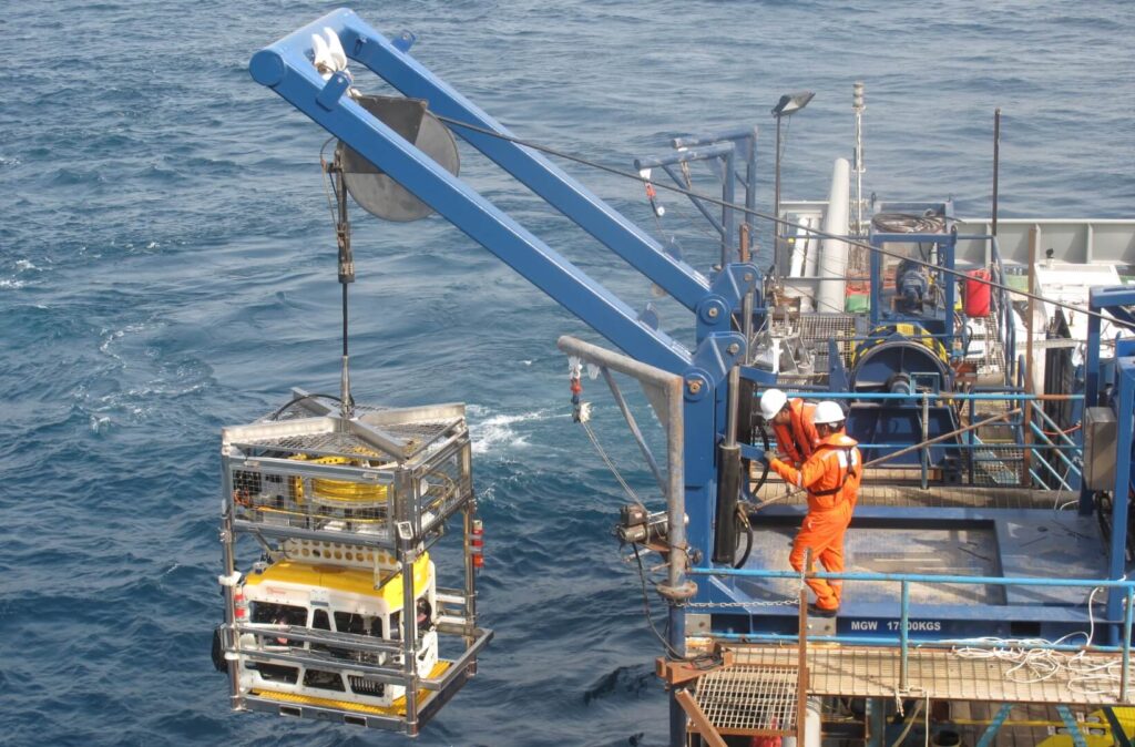
ROV SurveyInspections A Remotely Operated Vehicle (ROV) controlled from the surface, is highly manoeuvrable and able to provide video and still camera imagery along with information from various other sensors to observe, inspect, map and measure the condition of subsea assets. We operate ROVs to gather data for the following tasks: Pipeline inspection surveys (as-laid, […]
Construction Support
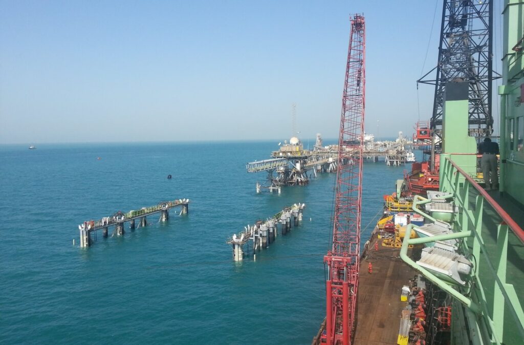
ConstructionSupport We provide construction support services to our clients to allow the safe installation of offshore assets. These activities utilise precise surface and subsea positioning data to install surface and subsurface assets. Horizon performs construction support services for our clients and can help to complete a project on time, in budget and with safe operations. […]
Offshore Geophysical Surveys
OffshoreGeophysical Survey Horizon performs geophysical surveys to gather detailed data required by design engineers for the installation of offshore structures, subsea cables and pipelines. That data is used to: Map seabed morphology and sub-seabed conditions Profile geological features Detect geohazards Provide a seabed and sub-seabed reference for geotechnical investigations We operate a fleet of owned […]
Hydrographic Surveys
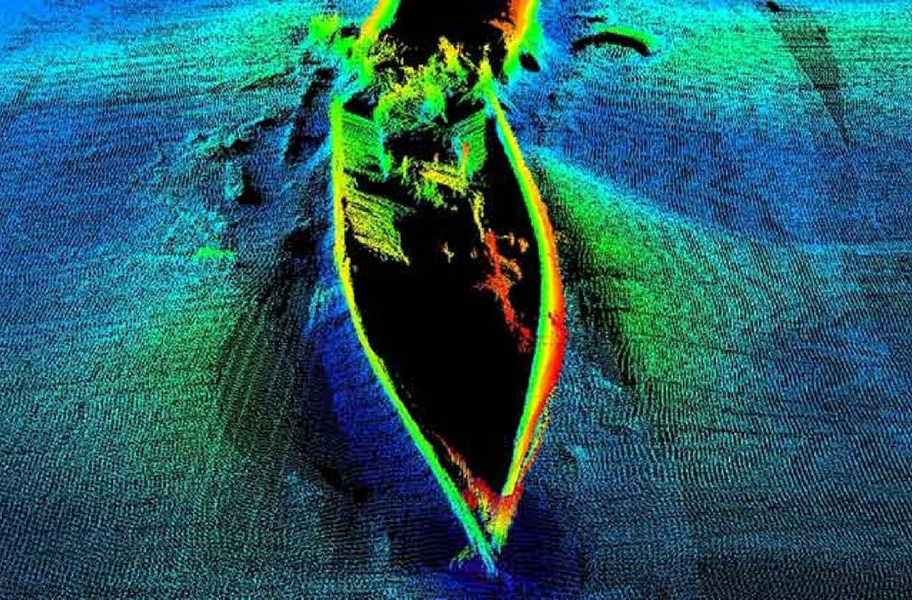
Hydrographic Surveys Horizon performs hydrographic surveys to IHO standards to gather seabed data required for navigational, engineering, and design purposes. The data is used for: Site characterisation Seafloor charting Locate man-made and natural objects (debris, shipwrecks, UXO, subsea structures, coral reefs) Pre / post engineering surveys Pipeline and cable route surveys Dredging support, port and […]